Cyclone ‘Senyar’ forms near Malacca, well-marked low in bay

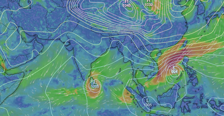
A weather disturbance over the Strait of Malacca intensified rapidly early Wednesday, developing first into a Deep Depression and then strengthening into Cyclonic Storm “Senyar”, according to the Bangladesh Meteorological Department (BMD).
At 6:00am Wednesday, November 26, Senyar was centred near latitude 5.0°N and longitude 98.0°E, and is expected to move westwards.
Meanwhile, the low-pressure area over the southwest Bay of Bengal and the adjoining Sri Lankan coast has intensified into a well-marked low, also at 6:00am Wednesday.
Meteorologists forecast that it will move north–northwest and may intensify further over the next day.
Warning for fishermen
Authorities have advised all fishing boats and trawlers in the north Bay of Bengal to avoid venturing into the deep sea until further notice due to rough conditions and strong winds linked to both systems.
No Threat to Bangladesh Coast
Despite concerns over new cyclonic activity, the Met Office said Cyclone Senyar poses no threat to the coastlines of Bangladesh or India.
The system is expected to weaken gradually while still at sea and may ultimately make landfall along the coasts of Malaysia or Indonesia instead.
Meteorologists continue to monitor both systems closely as the Bay of Bengal remains active during this late-season weather pattern.